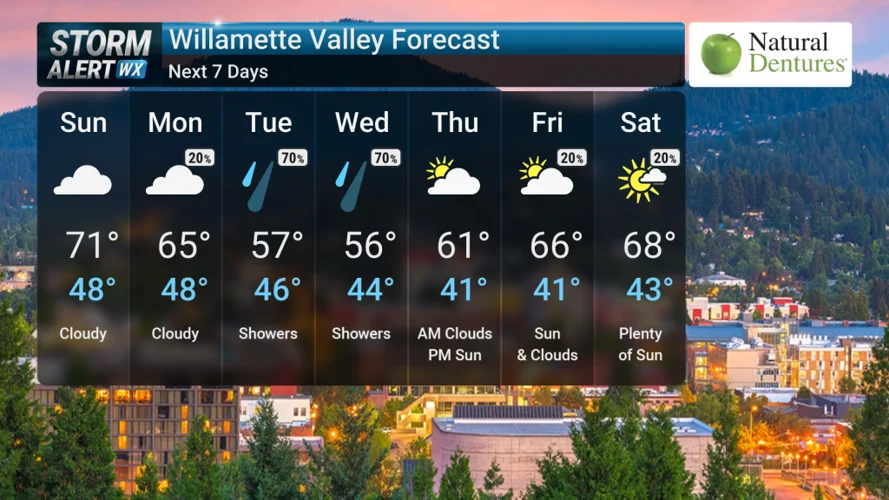
A stretch of dry and mild weather will give way to a wetter pattern mid-week as showers return and temperatures trend cooler across the Willamette Valley and Umpqua Basin.
Sunday: Cloudy but Mild
Overnight conditions will stay mostly clear before turning partly cloudy, with lows dropping into the upper 40s. Sunday is expected to remain mostly cloudy across the region, with daytime highs reaching the low 70s, keeping conditions mild and comfortable.
Monday: Cloud Cover Continues
The new week begins with persistent cloudiness on Monday. Temperatures will gradually cool, with highs expected near the mid-60s, signaling a shift toward a more unsettled weather pattern.
Tuesday: Rain Returns Early
A noticeable change arrives Tuesday as light rain moves in during the morning hours, followed by scattered showers throughout the afternoon. Temperatures will dip further, with highs only reaching the upper 50s, marking a clear cooldown compared to the weekend.
Wednesday: Wet Conditions Persist
Wednesday continues the active weather pattern with light rain expected early in the day and additional afternoon showers. Highs will remain cooler in the mid-50s, keeping conditions damp and cloudy across much of the region.
Thursday: Gradual Improvement
By Thursday, conditions are expected to improve as skies begin to clear to partly cloudy. Temperatures will respond with a slight rebound into the low 60s, bringing a more comfortable end to the week.
Outlook
Higher elevations in the Cascade Range will also experience the same transition, shifting from wet conditions early in the week to drier weather by Thursday.
Overall, the region will move from a mild, cloudy start to the week into a cooler, wetter midweek pattern before slowly improving again heading into the weekend.


Leave a Comment