


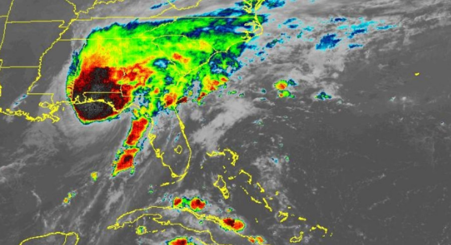
Friday night sees the central Gulf Coast deteriorating fast as Hurricane Isaias closes in on the Florida Panhandle, veering a bit east of earlier forecasts toward Fort Walton Beach.
The storm has shed some wind, now a solid Category 2 hurricane with sustained winds of 110 mph. AccuWeather forecasters predict it will hit the coast between 9 and 10 p.m. ET on Friday.
This landfall arrives precisely two years after Hurricane Milton battered Siesta Key, Florida, on Oct. 9, 2024, the last U.S. hurricane to make landfall at 8:30 p.m.
Despite the modest wind reduction, Isaias still rates a 3 on AccuWeather’s RealImpact Scale, reflecting the combined dangers of heavy rain, storm surge, fierce winds, and tornadoes.
Watch live:
“The Saffir‑Simpson scale tells you how strong a storm’s winds are. The AccuWeather RealImpact Scale for Hurricanes tells you what a storm will actually do by accounting for flooding rain, storm surge, and total damage and economic loss, not just wind speed,” said AccuWeather expert meteorologist Carl Erickson. “It gives people a far more complete picture of the threat they face.”
Wind gusts ranging from 100 to 120 mph could still strike the impact zone, putting Pensacola, Fort Walton Beach and Destin at risk for dangerous conditions and storm‑surge flooding.
As night turns to Saturday, the storm moves inland, unleashing damaging winds across Alabama that could topple trees and knock out power. It also carries a serious flash‑flood threat, with an AccuWeather Local StormMax of 25 inches. Tornado risk stays elevated through the night over the Florida Panhandle, southern Alabama and southern Georgia.
By Saturday evening, Isaias’ eye should sweep across northern Alabama and Mississippi before entering Tennessee west of Nashville. Its wide band of heavy rain and gusty winds will affect major inland hubs such as Atlanta, Nashville and Charlotte.
Rainfall totals of 4 to 8 inches could trigger severe flash flooding in southern Alabama, western Georgia and the Florida Panhandle. Forecasters also warn of mountain runoff and mudslides in the southern Appalachians, particularly in northern Georgia, western North Carolina and eastern Tennessee.
Further afield, 40‑ to 60‑mph gusts may topple trees and disrupt power from southeastern Louisiana through western Georgia and up into Pennsylvania’s Laurel Highlands. Meanwhile, the Atlantic coast will see rough surf, coastal flooding and beach erosion from northeastern Florida up to Virginia.







Leave a Reply