

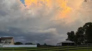
HOT, HUMID JUNE WEATHER: Through tomorrow, Alabama’s weather will stay mostly the same. Days will be partly sunny with highs generally in the low 90s, and widely scattered showers and thunderstorms will pop up around the state. The best chance for a shower or storm both days will run from about noon until 8 p.m., with the odds of any one spot getting wet sitting at 25-35 percent.
Showers and thunderstorms will become more widespread Sunday over the northern half of the state as a surface front and upper trough approach. Rain won’t fall all day, but it could come down heavily at times as a strong surge of tropical moisture pushes northward. South Alabama will see only widely scattered showers on Sunday.
NEXT WEEK: Global models still point to a good chance of showers and thunderstorms Monday, mainly along and south of I-20 (Tuscaloosa to Birmingham to Anniston). Drier air will push into the northern third of the state, keeping most places rain-free there.
On Tuesday, the main coverage of showers and storms will shift to along and south of U.S. 80 (Demopolis to Montgomery to Opelika) as the drier air continues sagging southward. North Alabama should stay generally rain-free with lower humidity levels.
Over the latter half of the week, the weather looks routine for June, with partly sunny days and a few spotty showers around. Heat levels will ease next week, with highs in the 80s.
TROPICS: Disorganized showers and thunderstorms are occurring over the Yucatan Peninsula and the adjacent Bay of Campeche, and a broad area of low pressure is expected to form in this area later today. Environmental conditions look only marginally conducive for development before the system moves inland over eastern Mexico late tomorrow or Sunday. The chance of development sits at just 10 percent.










Leave a Reply