

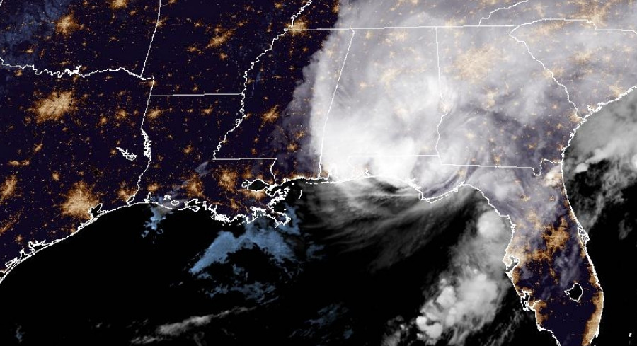
Friday night, Hurricane Isaias slammed into the Florida Panhandle between Pensacola and Destin, unleashing fierce winds, pounding rain, and a storm surge that clogged roads and toppled trees throughout the area.
Making landfall as a Category 2 storm with sustained winds around 110 mph, Isaias arrived precisely two years after Hurricane Milton battered Florida’s Gulf Coast on Oct. 9, 2024,the last hurricane to touch the United States.
Powerful gusts have already left over 423,000 homes and businesses in Florida, Alabama and Georgia without electricity, and utility crews must wait for the winds to subside before they can send out bucket trucks.
Catastrophic, life‑threatening flooding surged along the coast, prompting officials to declare a Flash Flood Emergency for southern Okaloosa County,including Fort Walton Beach, Wright and Niceville,as torrential rains overwhelmed drainage and turned streets into rivers.
Even though wind speeds eased a bit before the coast, Isaias kept a rating of 3 on the AccuWeather RealImpact Scale for Hurricanes, reflecting its severe flooding, storm surge, damaging gusts and tornado threats.
“The Saffir‑Simpson scale tells you how strong a storm’s winds are. The AccuWeather RealImpact Scale for Hurricanes tells you what a storm will actually do by accounting for flooding rain, storm surge, and total damage and economic loss, not just wind speed,” said AccuWeather expert meteorologist Carl Erickson. “It gives people a far more complete picture of the threat they face.”
Florida Gov. Ron DeSantis set a 11 p.m. news conference in Tallahassee to share state emergency updates and discuss early damage reports.
Overnight, damaging winds and heavy rain bands will push northward across Alabama, increasing the chance of widespread tree loss and extended power outages. A Local StormMax of up to 25 inches remains possible, and tornado risk persists across the Florida Panhandle, southern Alabama and southern Georgia.
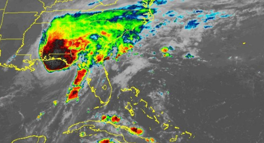
By Saturday, Isaias’s core is expected to sweep across northern Alabama and Mississippi before entering Tennessee west of Nashville. Its expansive outer bands will deliver gusty winds and heavy rain to major inland cities such as Atlanta, Nashville and Charlotte.
Rainfall totals of 4‑8 inches could spark additional flash flooding in southern Alabama and western Georgia, while runoff threatens flash floods and mudslides across the southern Appalachian mountains, especially in northern Georgia, western North Carolina and eastern Tennessee.
Wind gusts of 40‑60 mph may topple trees and disrupt utilities along an inland stretch from southeastern Louisiana to western Pennsylvania, and rough surf, beach erosion and coastal flooding will persist along the Atlantic shoreline from northeastern Florida up to Virginia.







Leave a Reply