

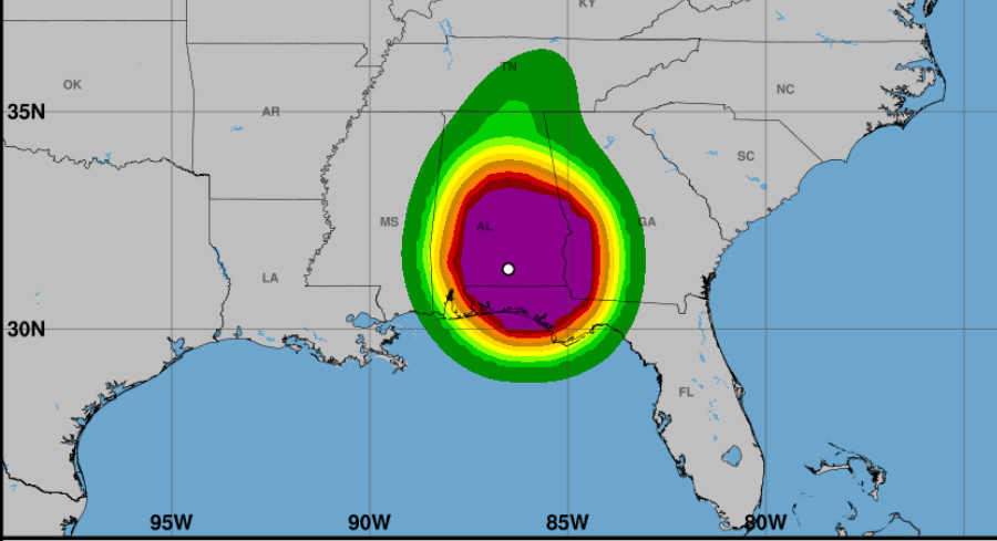
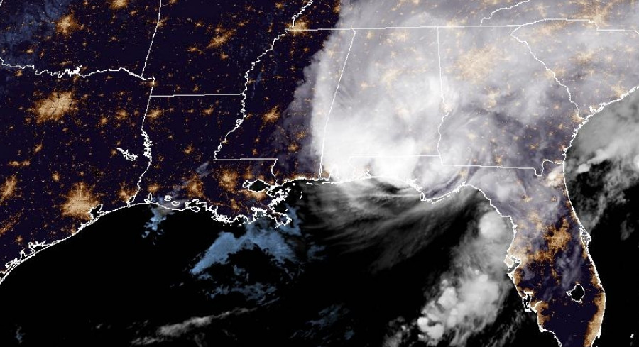
Hurricane Isaias slammed into the Destin area on Friday evening as a Category 2 storm with 105‑mph winds, just six miles per hour short of major‑hurricane strength. Coastal storm surge and hefty surf began to recede on Saturday, but the fast‑moving system already knocked out power for about one million utility customers across Florida, Alabama and Georgia by early morning.
Forecasters observed that the storm intensified dramatically before landfall, gaining 35 mph in wind speed within a single day. The National Hurricane Center recorded peak sustained winds of 120 mph on Friday morning, classifying Isaias as a Category 3 hurricane at its strongest. It slipped back to Category 2 just before hitting land as coastal friction and rising wind shear disrupted its core.
> “Isaias now holds the record as the latest forming first hurricane in the Atlantic basin, breaking the previous record set by Hurricane Four in 1905 by 3.5 hours,” said AccuWeather Lead Hurricane Expert Alexander DaSilva.
AccuWeather assigned the storm a 3 on its RealImpact Scale for Hurricanes, highlighting the threats of flooding, wind damage and economic disruption.
Although interior wind speeds are easing, meteorologists warn that Isaias’s rapid forward motion will drive dangerous gusts far inland, especially across Alabama, Tennessee and neighboring states. Sustained tropical‑storm‑force winds of 40‑60 mph are expected over a broad area.
> “Because of the swift forward speed and broadening wind field of Isaias as the storm moves inland, damaging winds and power outages are likely to extend well inland,” explained AccuWeather Chief Meteorologist Jon Porter.
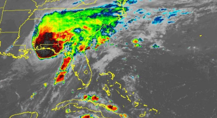
Along the Gulf Coast, water and surge levels are falling, but rough surf and shoreline debris continue to pose hazards for swimmers through Saturday. Heavy rain will shift northward, delivering widespread totals of 1‑4 inches across the Southeast, with bands of 4‑12 inches near and east of the storm’s track. AccuWeather’s Local StormMax rainfall potential tops out at 25 inches.
Forecasters emphasized that Isaias differs markedly from 2024’s Hurricane Helene, mainly in speed and track.
> “Isaias will be tracking much farther to the west into the Southeast states, when compared to Helene,” Porter noted. “Helene was a more powerful but much slower‑moving storm than Isaias. There was also flooding rainfall for the days ahead of Helene’s approach in the southern Appalachians.”
Porter added that while flash flooding remains a serious concern, the storm’s faster pace means rain will fall over hours rather than days, keeping the overall flood risk lower than Helene’s.
Severe weather also stays on the table along the eastern edge of the storm’s path.
> “Another hazard from the storm will be the risk of severe thunderstorms, including tornadoes and waterspouts,” said AccuWeather Chief On‑Air Meteorologist Bernie Rayno. “The bulk of the severe weather is likely near and east of the center, but that risk can extend for hundreds of miles to the east this weekend.”
Guided by an approaching dip in the jet stream from the Plains and high pressure off the mid‑Atlantic, the tropical system is expected to move north toward the Ohio Valley, then turn east across the Appalachians and exit off the East Coast by Monday.





Leave a Reply